72 Microseasons of the Pacific Northwest
68/72: Dec 7 to 11
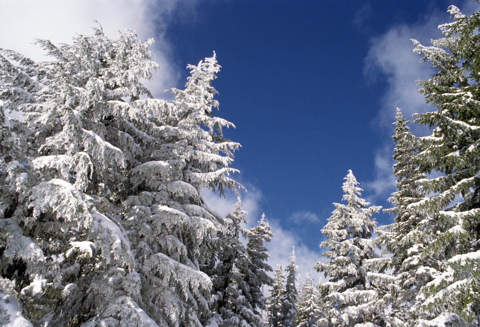
Cascade snowpack builds deep. Winter's water bank accumulating.
What the season brings?
Early December marks significant snowpack accumulation in the Cascade and Olympic mountains, with each storm system adding depth to the critical winter water storage that sustains the Pacific Northwest through summer. December storms typically deliver 6-18 inches of snow per storm at ski resort elevations (4,000-6,000 feet), with major atmospheric river events occasionally bringing 2-6 feet, while higher elevations receive even greater accumulation, building the foundation for the season's snowpack. This accumulated snow serves as a natural reservoir, storing winter precipitation and releasing it gradually through spring and summer melt. Snowpack is measured at numerous SNOTEL sites throughout the mountains, providing crucial data for water supply forecasting, hydroelectric operations, and streamflow predictions. Deep early-season snowpack creates excellent skiing conditions and promises healthy summer streamflows for salmon and agriculture, while poor snowpack years trigger drought concerns and water management challenges throughout the following summer.
Foods to Mark the Season
Winter storage crops shine in December—locally stored apples, winter squash, and sunchokes from fall harvest, alongside hearty root vegetables like parsnips and beets that sweeten with cold storage, perfect for warming winter stews and roasts.
Things to Do
Hit the slopes as Pacific Northwest ski resorts open for the season with fresh December snowfall—Mt. Baker, Crystal Mountain, and Stevens Pass offer exceptional early-season powder conditions. Check SNOTEL data online to track real-time snowpack accumulation across the Cascades.
Frequently Asked Questions
Visions of the Season
Read more
Each microseason is approximately 5 days, marking the subtle changes in nature throughout the year.